
Hocking Hills State Park is an Ohio state park located in the Hocking Hills region of Hocking County in southeastern Ohio, just outside of Columbus. In some areas the park adjoins the Hocking State Forest. Within the park are over 25 miles of hiking trails, rock formations, waterfalls, and recess caves. While there are many options for lodging, the closest cities are Logan and Lancaster.
The park has a rich history and was once the home to several Native American tribes in the mid-1700s. There are seven separate hiking areas for various skill levels, including Old Man's Cave, Ash Cave, Cantwell Cliffs, Conkle's Hollow (nature preserve), Cedar Falls, Rock House and Hemlock Bridge Trail to Whispering Cave. Ziplining, canoeing, rock climbing, and horseback riding are offered by independent businesses in the area. Camping facilities are also available, and the John Glenn Astronomy Park offers the perfect place for stargazing.
The trails are open from dawn to dusk, all year round, including holidays. The state park and the hiking trails are free without entrance fees for walking the trails or for parking. You must stay on the designated trails. Naturalist-led hikes, programs, and special events are all free.
Many of the water features are seasonal and are more pronounced during the spring after a rain.
Below is a list along with descriptions, GPS coordinates, interactive maps that can provide directions, and our photographs of what we feel are the most photogenic locations.
All photos copyright John Hultgren.
Old Man's Cave
Parking: N 39°26.1354', W 082°32.4696'
Old Man's Cave is a large recess cave that is named for the hermit Richard Rowe who lived there. Rowe and his family came to the Ohio River Valley around 1796 to establish a trading post and he traveled throughout Ohio in search of game. Rowe is buried beneath the ledge of the cave. Earlier residents of the cave were two brothers, Nathaniel and Pat Rayon, who came to the area in 1795 and built a cabin 30 feet north of the cave entrance. Both brothers are buried in or near the cave and their cabin was later dismantled. There is evidence that a few Native American tribes occupied the area in the 1600s and 1700s.
The Old Man’s Cave hiking area is at the north end of Hocking Hills State Park and is made up of eight major trail routes. The main trail route in the area is Grandma Gatewood Trail to Gorge Exit Trail and, depending on where you exit, it is 1 or 1-½ miles long. Access to other trails is available along this path.
Many of the trails in this park are one-way.
Start exploring at the Visitor's Center adjacent to the parking lot.
1 GPS: N 39°26.1726', W 082°32.3394'
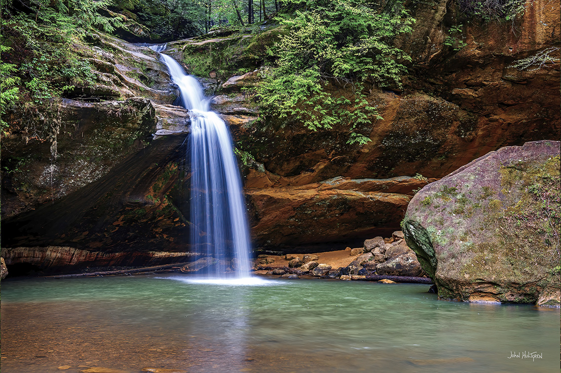
Upper Falls and Stone Bridge over the falls
Upper Falls is a photogenic waterfall with a bridge over the top.
Here at the Upper Falls, the Grandma Gatewood Trail begins its six-mile course connecting three of the park's areas: Old Man's Cave to Cedar Falls to Ash Cave. This same trail has been designated as part of Ohio's Buckeye Trail as well as part of two national systems — the North Country Scenic Trail and America's Discovery Trail.
Along the length of the trail, the gorge cuts through the entire 150-foot thickness of the Black Hand sandstone. The full distance of the gorge is approximately one half mile.
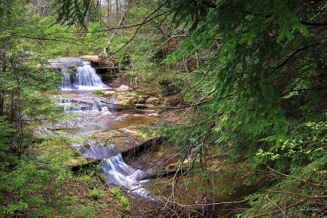
The Upper Falls can be viewed in two sections.
2 GPS: N 39°26.1252', W 082°32.4006'
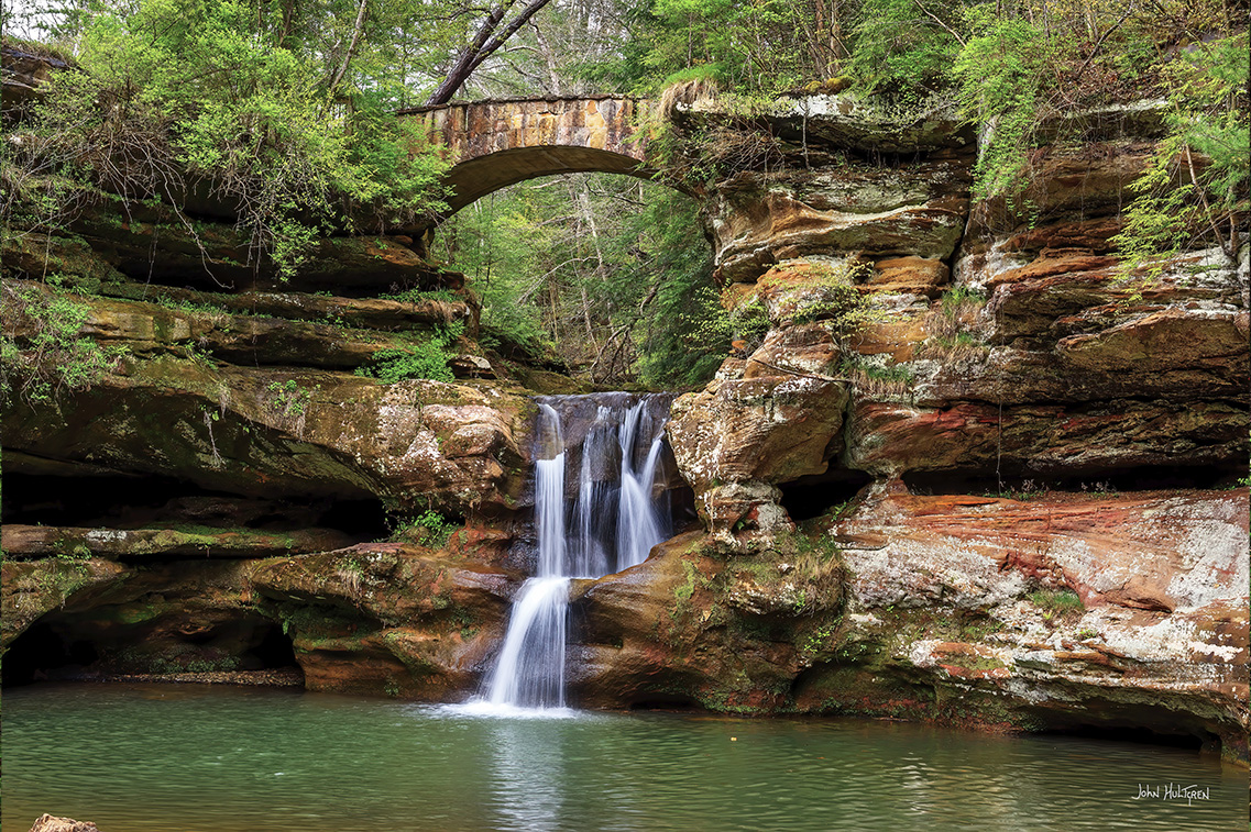
Devil's Bathtub
Upper Falls spirals into a bathtub shaped basin.
Devil’s Bathtub has been said to go all the way to Hades, and the sign next to it says climbing out is “virtually impossible”.
3 GPS: N 39°25.9980', W 082°32.5920'
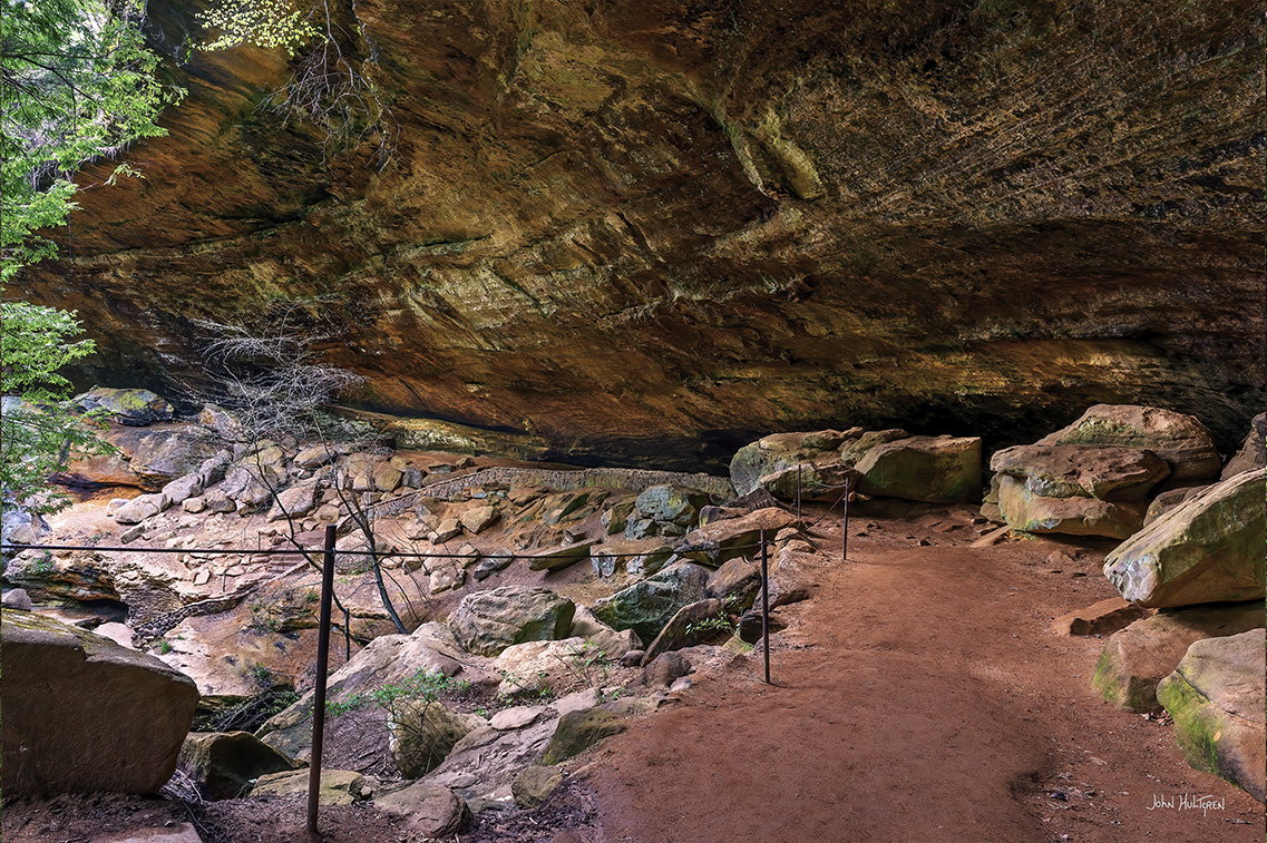
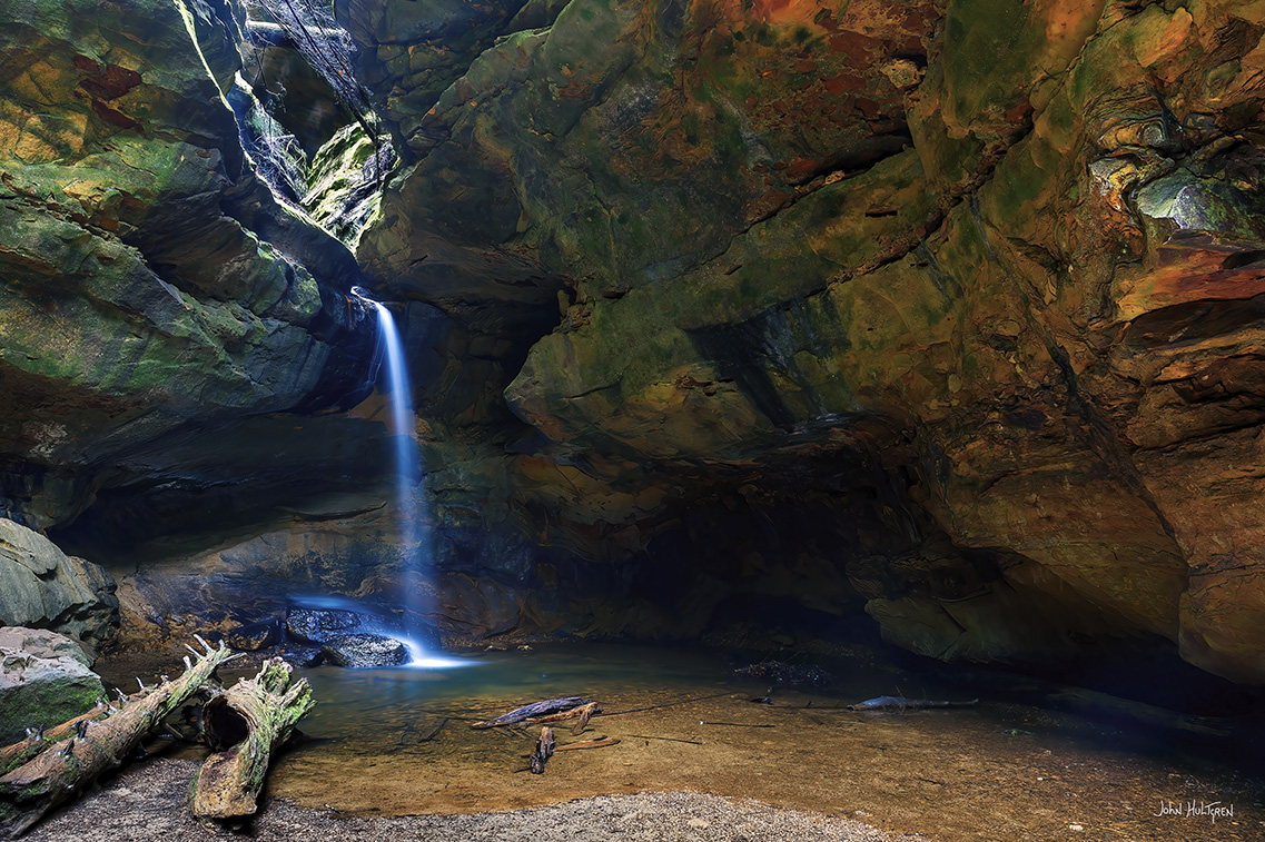
Old Man’s Cave
Old Man's Cave is a large recess structure naturally carved into rock in the gorge, with a waterfall, and it is the most popular of all the Hocking areas.
The recess of Old Man’s Cave is the most unique feature in this park and it sits 75 feet above the stream and measures 250 feet long. The scenery leading up to the cave is the prettiest in the whole park.
From the trail, cross over the bridge to get to the stone steps leading up to the cave, then walk through it and come out the other side.
4 GPS: N 39°25.9608', W 082°32.6508'
Lower Falls.
A single 25-foot waterfall with a large pool beside large boulders.
Past the bridge that continues to Old Man's Cave, the trail continues to Lower Falls on the Grandma Gatewood Trail.
5 GPS: N 39°25.9542', W 082°32.7072'
Bridge By Lower Falls
A stone bridge opposite the falls with the creek running under it. The gorge trail is about a half mile long.
6 GPS: N 39°25.9440', W 082°32.8020
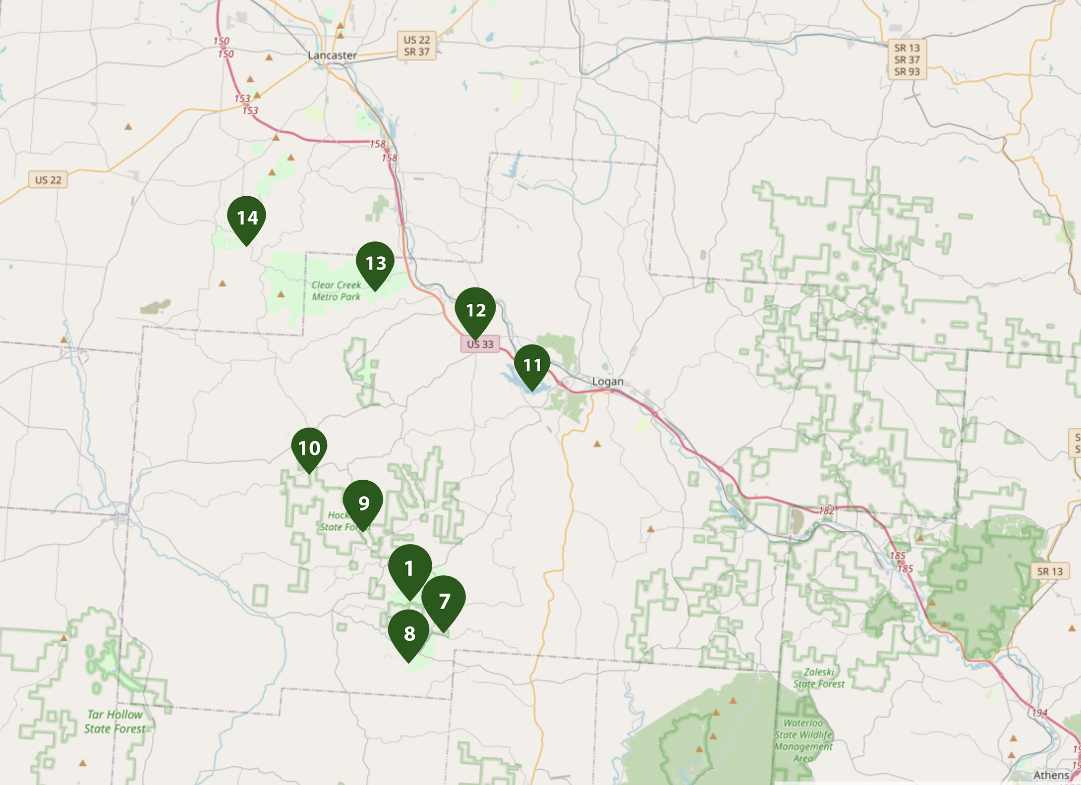
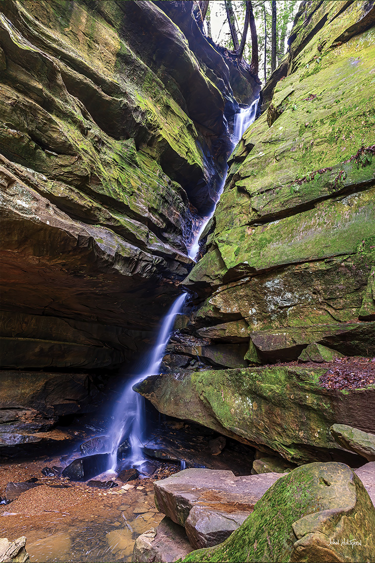
Broken Rock Falls
Broken Rock Falls spills down a tributary that flows into the creek downstream from the Lower Falls. The waterfall received its name because it looks like it's cutting a giant rock in half.

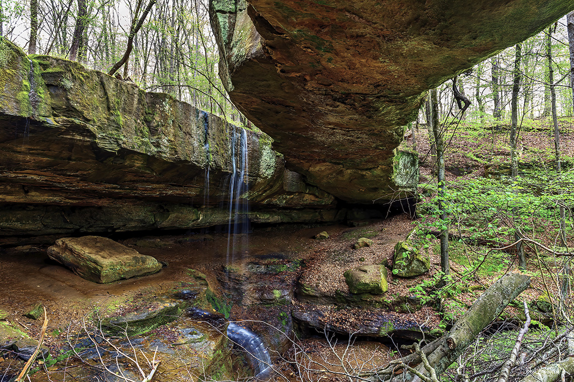
Cedar Falls
Parking: N 39°25.1340', W 082°31.4418'
7 GPS: N 39°25.1334', W 082°31.4898'
Cedar Falls
A scenic waterfall that has the largest volume of water flow in the park. The falls split into multiple streams around a rock and then come together again. The trail is 0.3 miles and the falls are close, only 2.1 miles, from Old Man’s Cave.
The trail leading to Cedar Falls passes through a remote, primitive chasm laden with hemlock and bound by steep rock walls and their accompanying grottos and waterfalls. The falls were misnamed by early settlers who mistook the hemlocks for cedars.
Ash Cave
Parking: N 39°23.7456', W 082°32.7432'
8 GPS: N 39°23.9598', W 082°32.6622'
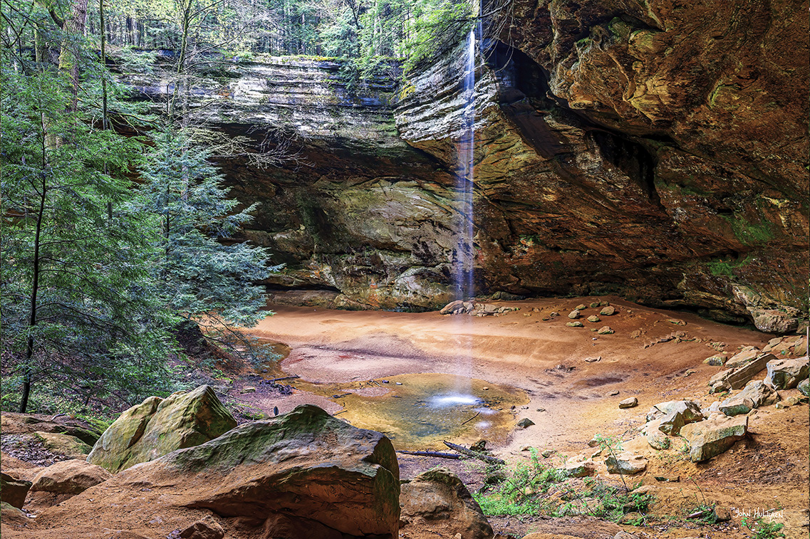
Ash Cave
Ash Cave is the largest, most impressive recess cave in Ohio. This is a large cave structure with a waterfall flowing from the top. There is a one way loop trail (hikers with mobility restrictions are allowed to return to the parking lot against hiking traffic on a level paved path) and after reaching the falls the return trail will take you up near the top of the waterfall where you can get a good photograph of the falls and cave.
The approach to Ash Cave is along a level paved trail through a narrow gorge lined with hemlocks, beech trees, and various other hardwoods. The valley floor offers brilliant displays of wildflowers in all seasons including large flowered trillium, Dutchman's breeches, trout lily, Jack-in-the Pulpit and jewelweed. The narrow gorge is approximately a quarter mile in length and gives way to the tremendous overhanging ledge and cave shelter.
The horseshoe-shaped cave measures 700-feet from end to end, 100-feet deep with the rim rising 90 feet high. A small tributary of the East Fork of Queer Creek cascades over the rim into a small plunge pool below. The cave was formed like the others in this region; the middle layer of the Black Hand sandstone has been weathered or eroded while the more resistant upper and lower zones have remained intact.
Ash Cave is named after the huge pile of ashes found under the shelter by early settlers. The largest pile was recorded as being 100 feet long, 30 feet wide and 3 feet deep. The source of the ashes is unknown but is believed to be from Indian campfires built up over hundreds of years. One other belief is that the Indians were smelting silver or lead from the rocks. Still another theory claims that saltpeter was made in the cave. Several thousand bushels of ashes were ultimately found. A test excavation of the ashes in 1877 revealed sticks, arrows, stalks of coarse grasses, animal bones in great variety, bits of pottery, flints and corn cobs.
Conkle's Hollow
Parking: N 39°27.1800', W 082°34.3260'
9 GPS: N 39°27.6090', W 082°34.6914'
Conkle's Hollow
Conkle’s Hollow is a narrow gorge with Black Hand sandstone cliffs rising 200-feet on either side. Seasonal waterfalls flow from the cliffs at many sites with their streams joining to form Pine Creek on the valley floor. The rocky gorge is considered to be one of the deepest in Ohio.
There are three trails accessible from the parking lot. The main photography attraction is the lower falls located at the very end of the middle trail, which is mostly flat and paved. Keep going a short distance after the paved trail ends, crossing the creek. The falls are seasonal and depend on rainfall.
Rock House
Parking: N 39°29.7840', W 082°36.8760’
10 GPS: N 39°29.7791', W 082°36.9836'
Rock House
A smaller cave structure with small openings in the cave. From the parking area to Rock House is a 0.9 mile hike that is fairly steep in some areas.
Rock House is the only true cave in the park and is a tunnel-like corridor situated midway up a 150-foot cliff of Black Hand sandstone. Rock House has a ceiling 25 feet high with a main corridor that is 200 feet long and 20 to 30 feet wide. The cavern was eroded out of the middle zone of the Black Hand sandstone. The resistant upper zone forms the roof and the lower zone forms the floor. Leaking water caused the hollowing of the corridor and this main joint or crack is very visible in the ceiling. A small series of joints run north to south at right angles to the main joint. Enlargement of this series of joints formed the window-like openings of Rock House.
There are seven Gothic-arched windows and great sandstone columns which bear its massive roof. Over the years Rock house has been used for shelter by past visitors. Hominy holes, small recesses in the rear wall of Rock House, served as baking ovens for Native Americans using the cave. By building a fire in the small recesses, the rock became heated on all sides, and food could be baked. Chiseled-out troughs or holding tanks can be found in the stone floor. When rainfall is abundant, springs of water permeate through the porous sandstone and flow into these troughs and, when full, continue across the floor and out of the windows, creating a water supply. According to local folklore, some of the "not-so-welcome" past visitors included robbers, horse thieves, murderers and even bootleggers, earning Rock House its reputation as Robbers Roost.
Lake Logan
11 GPS: N 39°32.3280', W 082°27.1620'
Lake Logan
A picturesque little lake near the town of Logan. This is a good spot for fall landscape photos. In the morning you can get composition photos from the marina, fishing pier and the beach and then go to the western side of the lake for sunset photos.
Lake Logan State Park is an Ohio state park located in Hocking County. Lake Logan Dam is directly accessible off State Route 664 just southwest of the county seat of Logan. The park lies in the Hocking Valley, formed by the Hocking River and was created in 1955 with the construction of the Lake Logan Dam on Clear Fork Creek, a tributary of the Hocking River. Lake Logan is a 400-acre lake and is open to fishing, boating, ice fishing, ice boating and swimming.
Rockbridge
Parking: N 39°33.9762', W 082°29.9604'
12 GPS: N 39°34.5930', W 082°30.1062’
Rockbridge
Rockbridge (also known as Rock Bridge) is a small scenic nature preserve in the Hocking Hills area containing a natural stone arch. It is the longest arch of about a dozen stone arches in the state. Rockbridge is a state nature preserve rather than a park and there's a small public parking area, but no restrooms or picnic tables. Pets are not permitted in the preserve.
Rockbridge is a 100-foot long natural rock bridge with a waterfall. There is a short trail that leads down to the bottom where there is a small roped off photography area under the bridge. There is a one-mile long natural trail to the bridge and a longer 2.75 mile trail system at Rockbridge. Take the trail where it branches off to the left (marked with red blazes) for the shortest path to the bridge.
The bridge was originally a recess cave with a seasonal stream dropping through the cave roof. Eventually part of the roof collapsed but a length of the former cave ceiling remained as the stone arch. The trail continues and forks with one trail terminating at the base of the arch and the other leading to the bank of the nearby Hocking River. You can walk across the stone arch to the other side but be careful because there may be slippery mud on the bridge.
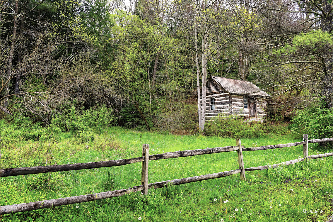
Clear Creek Metro Park
13 GPS: N 39°35.8680', W 082°32.9760'
Clear Creek Metro Park
A scenic metro park close to Logan with several old cabins and barns. Written Rock is a large colorful rock on the road just west of the park headquarters. Centuries of flooding by glacial meltwater have cut the present gorge area through Black Hand sandstone, leaving behind scenic cliffs and rugged formations overlooking Clear Creek. The park extends the length of the Clear Creek Valley, extending from the confluence of Clear Creek and the Hocking River in the East, and the town of Revenge in the West.
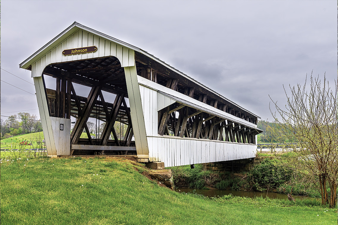
Johnston Covered Bridgee
14 GPS: N 39°36.8280', W 082°39.5340'
Johnston Covered Bridge
Also known as the Johnson Covered Bridge and the Terry Mill Covered Bridge, this covered bridge is located in Two Glaciers Park just a few miles west of Clear Creek Metro Park.
Built in 1887, this is a Howe Truss bridge that extends 98-feet with a 5-foot overhang on each end, 15-feet wide and 14-feet in height. In the 1930s, two full-length windows and canopies were added to allow visibility of oncoming traffic. The bridge remained in service until about 1990, when it was bypassed.

 ADVERTISEMENT