
Breaks Interstate Park, also known as "The Breaks," is a bi-state state park spanning nearly 5,000 acres located partly in southeastern Kentucky and southwestern Virginia in the Jefferson National Forest, at the northeastern terminus of Pine Mountain nestled in the heart of the Appalachian Mountains. The land is managed by an interstate compact between the states of Virginia and Kentucky.
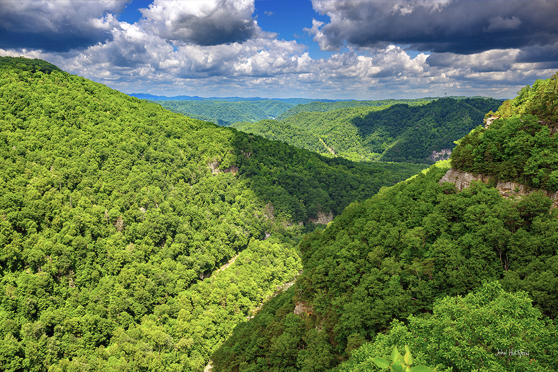
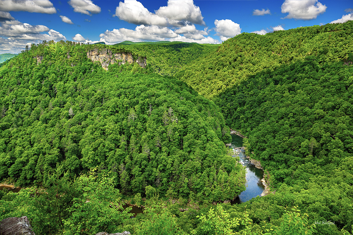
Breaks Interstate Park has been called the "Grand Canyon of the South" because the Breaks Canyon is one of the deepest gorges east of the Mississippi River. The Russell Fork and the Clinchfield Railroad (now the CSX Transportation Kingsport Subdivision) both pass through the park which is accessed via Virginia 80 and Kentucky 80 between Haysi, Virginia, and Elkhorn City, Kentucky. The park's main feature, Breaks Canyon, is five miles long and ranges from 830 to 1,600 feet deep. The canyon was formed by the Russell Fork through millions of years of erosion.
The park is open all year but may be closed during certain inclement weather events. A $3 day-use fee is charged per car for admittance ($10 fee per 15-passenger or more vehicle). The motel, cottages, and cabins are open year-round although the front desk is closed on Christmas Eve, Christmas, and New Year's Day, and the campground and yurt are available seasonally from spring until fall.
The Visitor Center is home to their historical and cultural museum, the gristmill, moonshine still, and the Counts cabin. The Visitor Center also hosts many of their seasonal discovery programs. The Rhododendron Restaurant is open seasonally and offers a variety of meals as well as a buffet on the weekends. Day Use river access areas at Ratliff Hole, Center Creek, and Garden Hole are closed at sunset each day and gates are locked at that time; unattended vehicles left after sunset are subject to fines and/or towing at the owner’s expense.
Below is a list along with descriptions, GPS coordinates, interactive maps that can provide directions, and our photographs of what we feel are the most photogenic locations.
All photos are copyright John Hultgren.
Breaks Interstate Park Visitors Center
GPS: N 37°17.2212', W 082°17.7687'
Rhododendron Lodge
GPS: N 37°17.1575', W 082°17.6931'
1 Trailhead GPS: N 37°17.1972', W 082°18.2772'
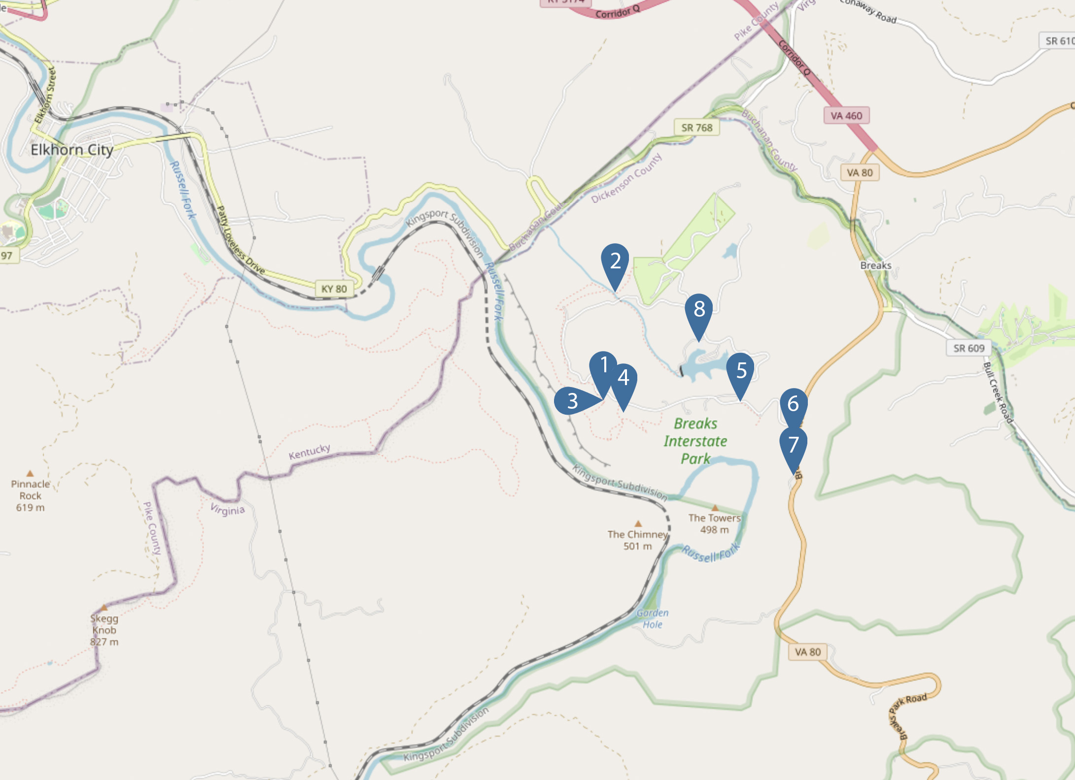
Overlook Trail
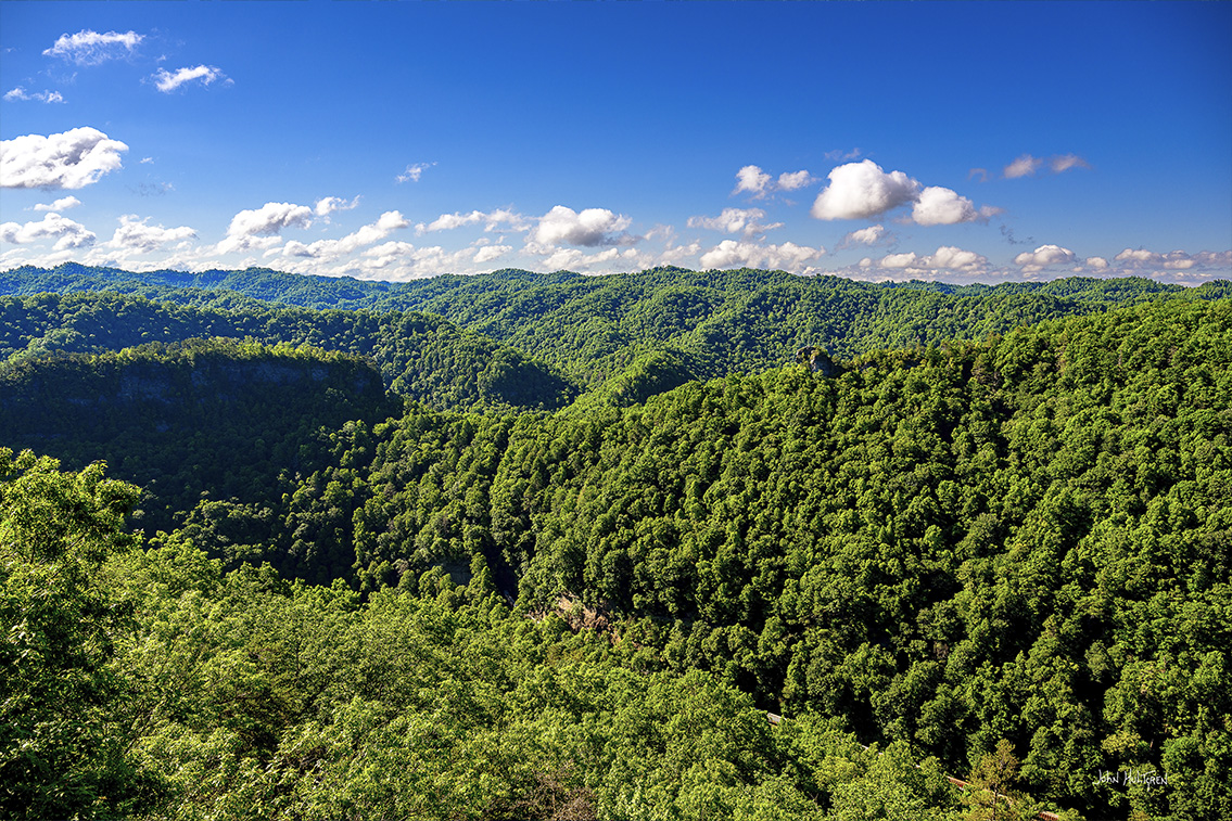
The Overlook Trail is one of the best ways to experience the beauty of the Breaks Canyon. The trail runs between the Clinchfield and Stateline Overlooks, offering hikers a variety of vantage points to take in the impressive views of the gorge and the river below. The trail is 1.2 miles out and back and is rated at moderate difficulty.
Explore the outer edge of the Breaks canyon while the Russell Fork roars nearly a thousand feet below you. It is here where one can best view the gorge that the Russell Fork of the Big Sandy River has carved through the heart of Pine Mountain. The trail runs between the Clinchfield and Stateline Overlooks, offering the hiker a variety of vantage points along the way. To see the best views that the Overlook Trail has to offer, hike the trail early in the morning before the fog begins to burn off out of the canyon. Cool mornings after a warm day offers the best chance of being able to watch a river of fog flow through the canyon. Another great option is to hike the Overlook Trail in the hour or two before sunset when the shadows grow long, silhouetting the hollows and highlighting the ridge tops. The Overlook Trail runs along the edges of steep cliffs, many without safety railings, so use extreme caution and pay attention to your footing.
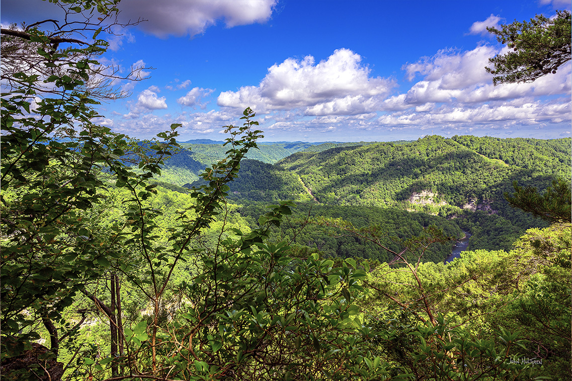
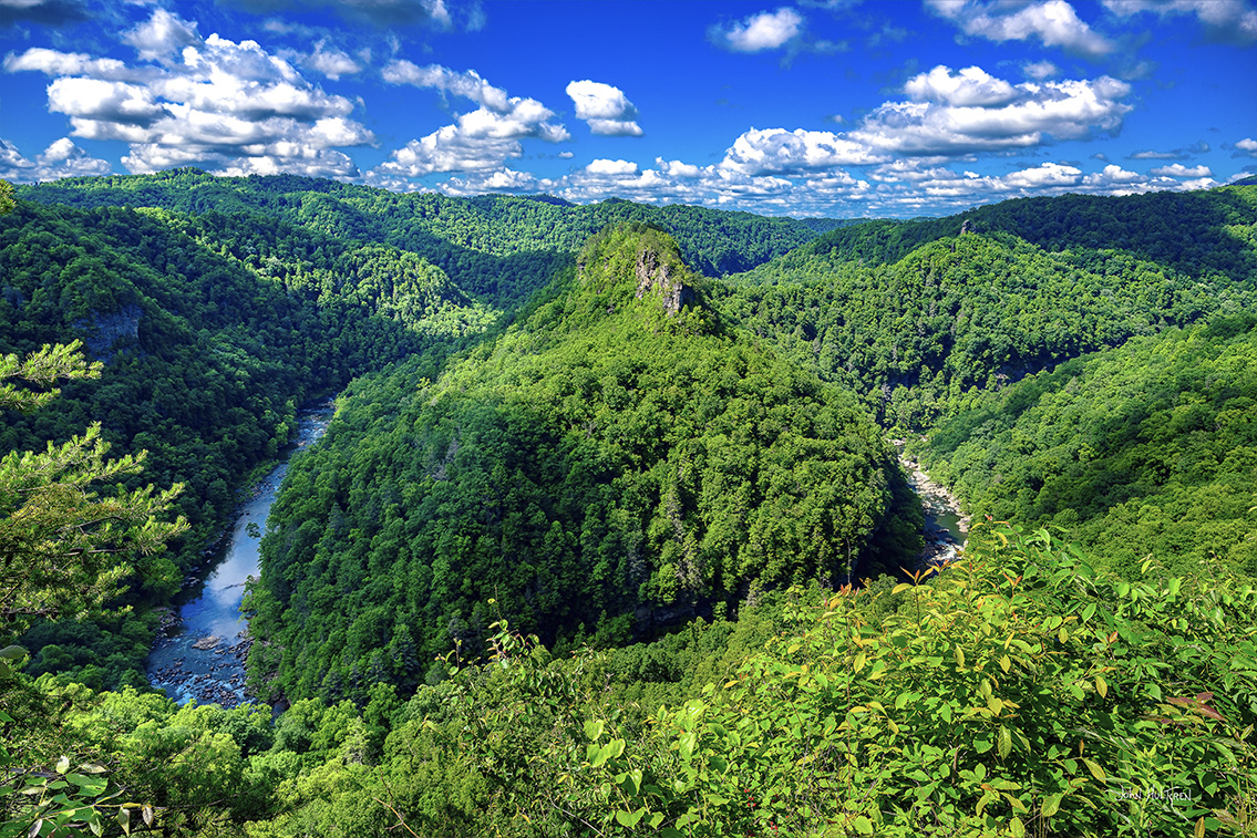
Pinnacle Rock
GPS: N 37°17.3538', W 082°18.4884'
Pinnacle Rock is a large outcrop that appears to balance itself high above Russell Fork.
State Line Overlook
GPS: N 37°17.5830', W 082°18.4896'
This overlook offers a different perspective of the gorge, looking north towards Virginia, and it is a great spot for sunrise photos when sunlight paints the cliffs in a golden light.
You can either return to your vehicle back along the Overlook Trail or hike Commission Circle and follow that road back to your parking spot.
Commission Circle
GPS: N 37°17.5770', W 082°18.4854'
2 Trailhead GPS: N 37°17.7510', W 082°18.0972'
Grassy Overlook Trail
Grassy Creek Overlook
GPS: N 37°17.7822', W 082°18.2304'
The Grassy Overlook Trail looks out over the Russell Fork below and the mountains in Kentucky. The trail begins in Campground B where there is no vistor parking at the trailhead, but there is a small parking lot for hikers right before the campground on the right.
3 Trailhead GPS: N 37°17.1894', W 082°18.3486'
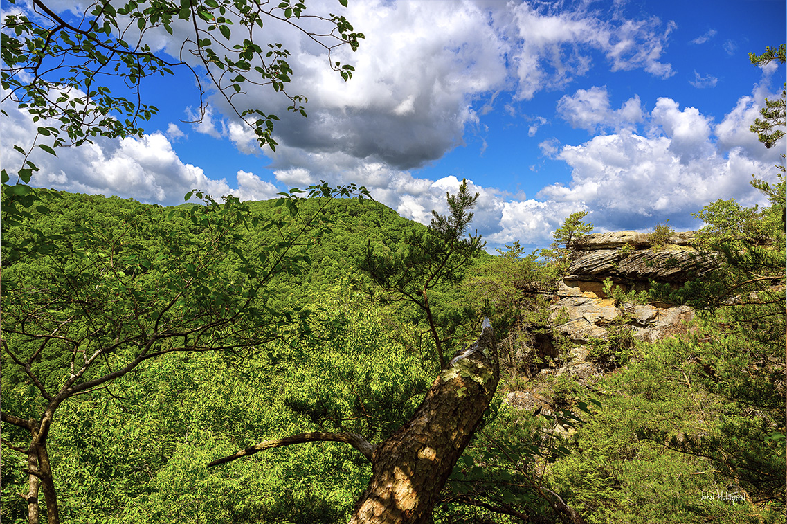
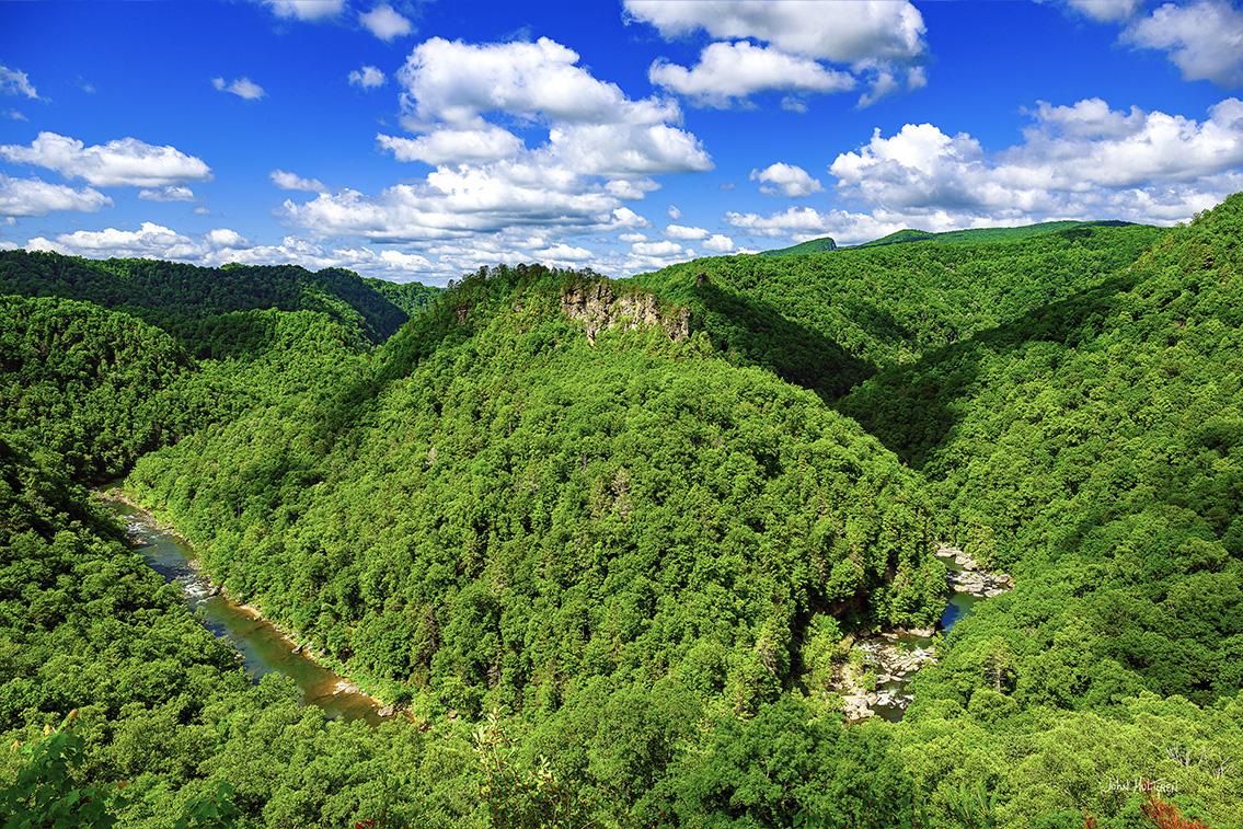
Clinchfield Trail
Clinchfield Overlook
GPS: N 37°17.1396', W 082°18.3486'
The Clinchfield Overlook looks down into the Russell Fork Gorge, which is known as "The Grand Canyon of the South." This view, exactly 1,000 feet above the river below, is the highest point in the park and looks out to the northern terminus of Pine Mountain.
4 Trailhead GPS: N 37°17.1738', W 082°18.2004'
Towers Tunnel Trail
Towers Tunnel Overlook
GPS: N 37°17.0292', W 082°18.2142'
The trail is 0.4 miles and rated easy. A view of the Russell Fork circling around in front of The Towers. Depending on the time of year, this may offer a better sunrise view than the Towers Overlook.

5 Trailhead GPS: N 37°17.1840', W 082°17.5764'
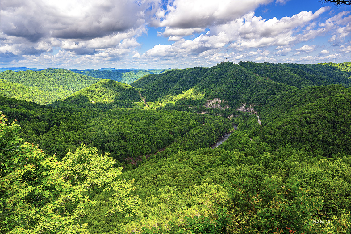
Towers Trail
Towers Overlook
GPS: N 37°17.0928', W 082°17.4840'
The Towers are a rugged sandstone cliff. You can view the Russell Fork circling around in front of The Towers, with the northernmost section of Pine Mountain in the background.
6 GPS: N 37°16.9764', W 082°17.3172
Mill Rock Overlook
Located along Route 80, it is just a short walk down to Mill Rock Point with one of the best views of The Towers.
7 GPS: N 37°16.8930', W 082°17.2794'
Lovers Leap Overlook
You can view The Towers from the road or take an 80 yard walk for a closer look. The elevation at the overlook is 1,630 feet and the elevation of the river is 1,040 feet, making the overlook elevation 1,590 feet. Indian legend tells of the tragic romance between an Indian brave and a beautiful maiden who were forbidden to marry because their two tribes were at war. Lovers Leap Overlook is named for these two ill-fated lovers who leaped to their death from the canyon rim to the rushing waters far below.
8 Parking GPS: N 37°17.4318', W 082°17.7840'
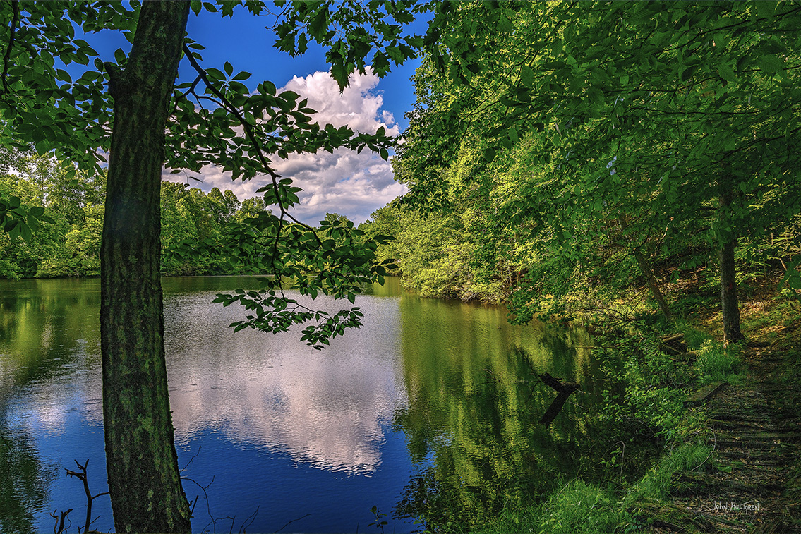
Laurel Lake
The calm waters of Laurel Lake reflect the beauty of the surrounding mountains, making it a great spot for landscape photography. You can also rent a boat and get some unique shots from the middle of the lake.

 ADVERTISEMENT