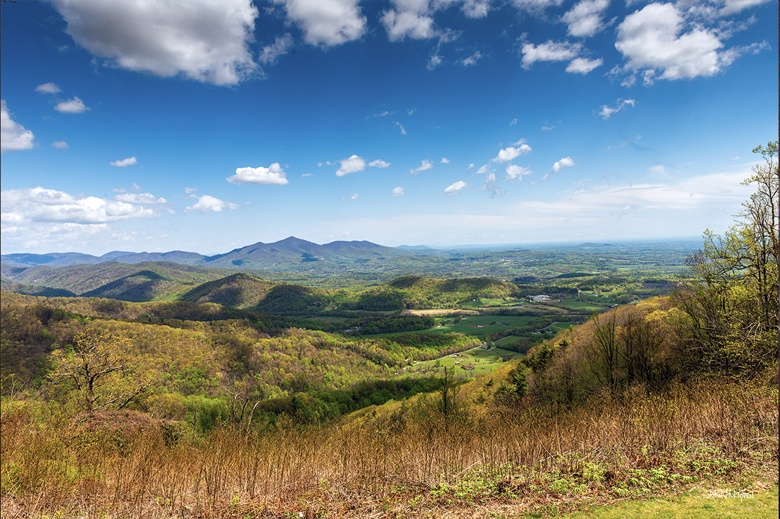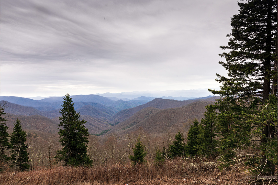
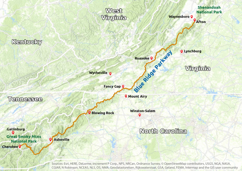
The Blue Ridge Parkway is a National Parkway and All-American Road located in the eastern United States, noted for its scenic beauty. The parkway is America's longest linear park that runs for 469 miles through 29 Virginia and North Carolina counties, linking Shenandoah National Park to Great Smoky Mountains National Park. It runs mostly along the spine of the Blue Ridge, a major mountain chain that is part of the Appalachian Mountains.
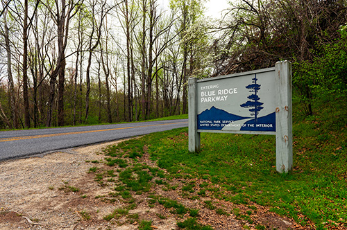
The Blue Ridge Parkway, a unit of the National Park System, is an area rich in natural and human history set in the scenic beauty of the Blue Ridge Mountains. The Parkway preserves a portion of this country's historic and scenic heritage for the benefit and enjoyment of the people.
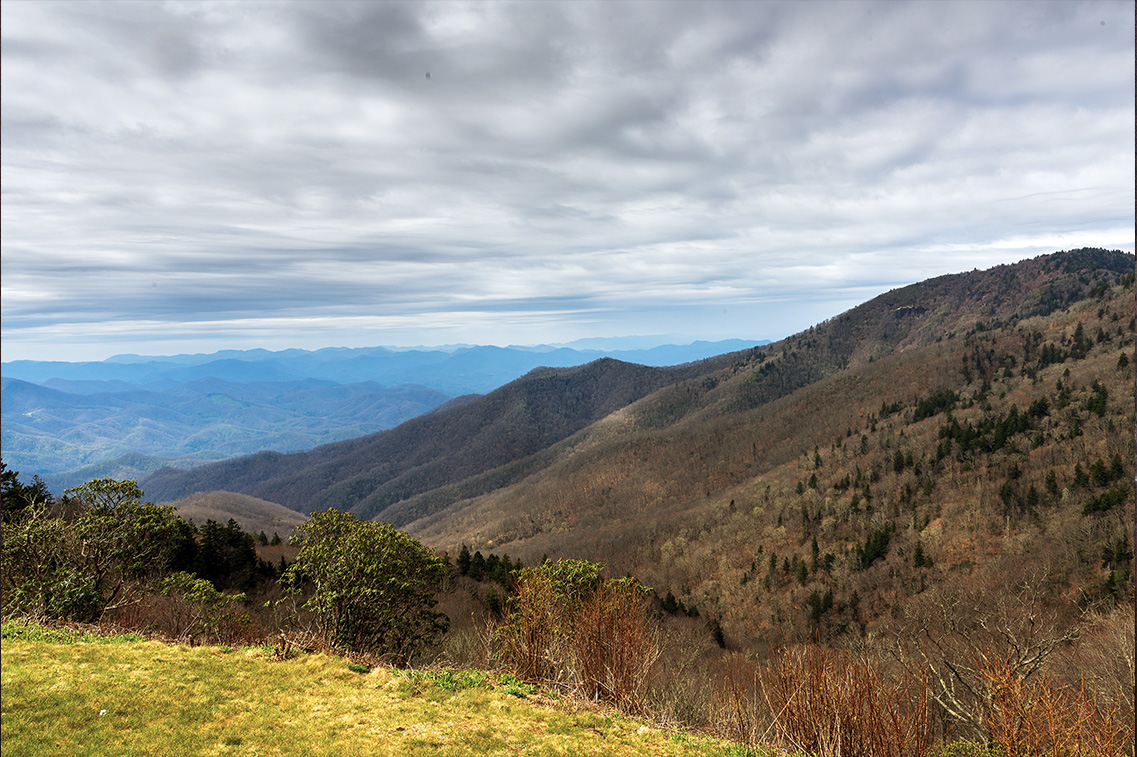
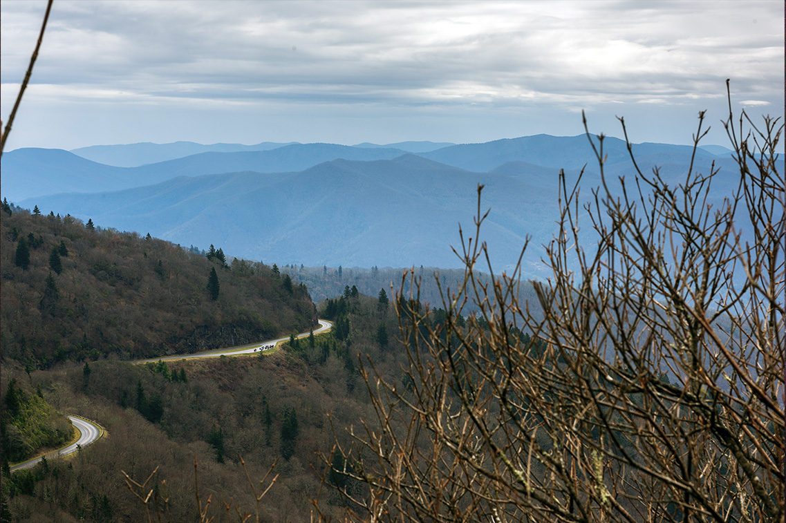
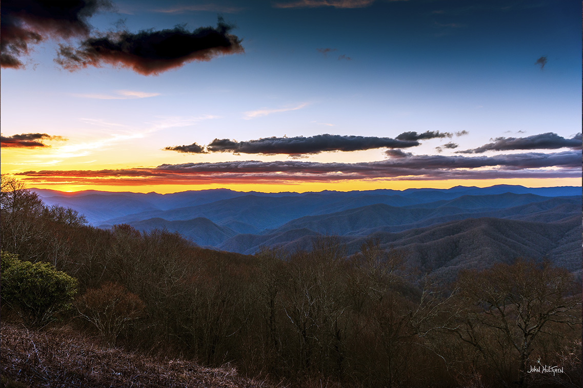
With a maximum speed of 45 mph, the highway offers drivers numerous and frequent opportunities to stop at overlooks, quaint mountain towns and hiking and biking trails. Even if you're not up for a long road trip along the entire parkway, there are many attractions along the entire length of the Parkway that are worth exploring. The views alone make it a must-do when visiting the Blue Ridge Mountains corridor.
Driving along the parkway is free, as is entrance to most of its attractions. Due to weather conditions, some attractions may be closed. Stretches of the roadway itself are also occasionally closed due to hazardous conditions or maintenance, so be sure to check the Parkway website at https://www.blueridgeparkway.org/ for any notices before you begin your trip.
I took a quick three-day trip to take the photos for this article and spent the night in Staunton, Virginia; West Jefferson, North Carolina; Marion, North Carolina; and Cherokee, North Carolina. It did feel rushed trying to visit all of the locations mentioned in this article in three days, but a good portion of the entire length of the Parkway can definitely be explored in three days if your time is limited.
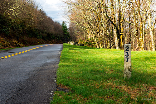
When the 469.1 mile Blue Ridge Parkway was built, stretching from Afton, Virginia south to Cherokee, North Carolina, each mile was marked with a mile post starting at 0 at the northernmost point and increasing as you travel south. Mile posts are only on the right side of the road while traveling south and are visible on the left while traveling north. Mile post locations are included in this article, along with GPS coordinates which are probably more useful for navigation today.
While the Blue Ridge Parkway does runs from north to south, it is certainly fine to start your trip at either end. If you start at the southern end, just work your way up this list from the bottom.
| The Blue Ridge Parkway | |
|---|---|
| Milepost | Attraction |
| 0 | Parkway start at Shenandoah National Park GPS: N 38°01.8960', W 078°51.4920' |
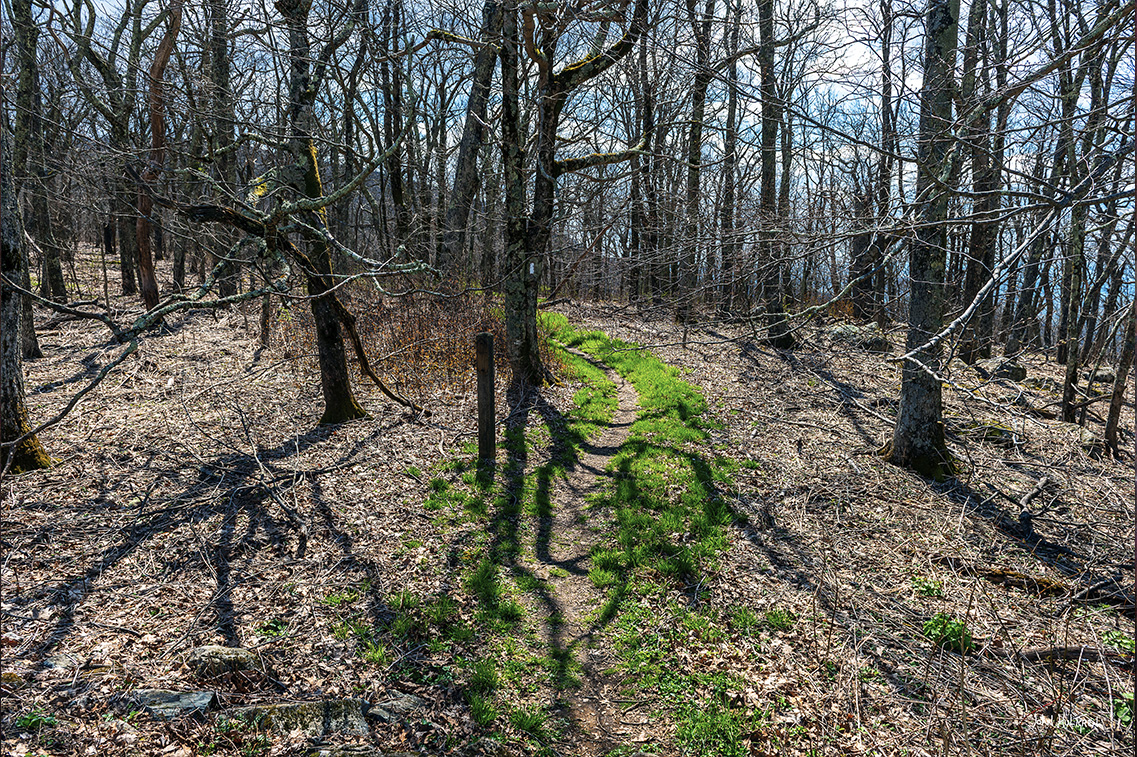
| 5.8 | Humpback Rocks Attractions include Humpback Rocks Visitor Center and Mountain Farm Museum. |
| 6 |
Humpback Gap Parking Area
Parking and Humpback Rocks Trail at GPS N 37°58.1142', W 078°53.8020' Humpback Rocks at GPS N 37°57.6780', W 078°54.0360' Humpback Gap Overlook provides parking for a hike up to Humpback Rocks. |
| 10.7 |
Ravens Roost Overlook
GPS N 37°56.0286', W 078°57.1410' Short 0.2 mile geological trail. |
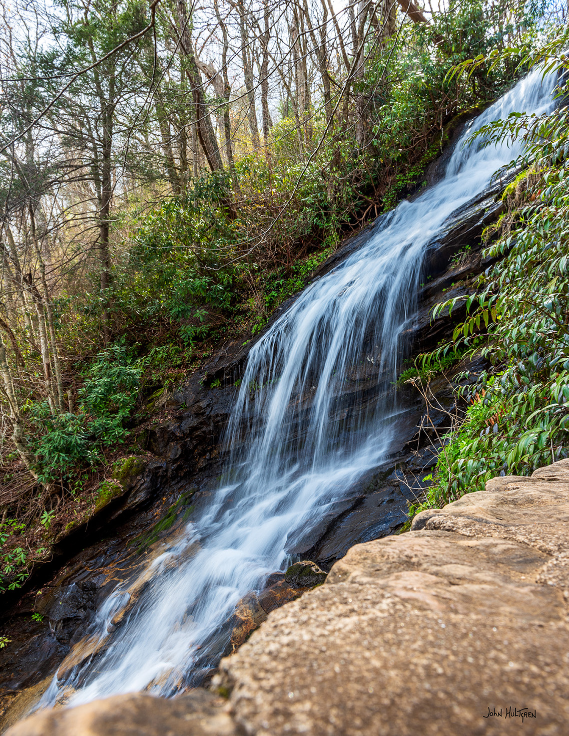
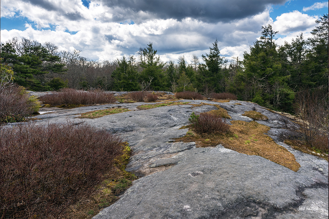
| 27.2 | Crabtree Falls Trail Parking at GPS: N 35°48.9276', W 082°08.7324' Crabtree Falls at GPS: N 35°49.1946', W 082°08.9394' |
| 69.1 |
James River Valley Parking Area
Visitor Center Parking at GPS: N 37°33.3306', W 079°21.9168' |
| 76.3 |
Appalachian Trail
The Appalachian Trail crosses the Blue Ridge Parkway at GPS N 37°31.4790', W 079°30.3144' |
| 95.2 |
Pine Tree Overlook
Overlook at GPS N 37.4459, W 79.7236 |
| 139 |
Cahas Knob Overlook
Overlook at GPS: N 37°05.6514', W 080°06.7512' |
| 143.9 |
Devil’s Backbone Overlook
Overlook at GPS N 37°02.1597', W 080°06.6456' |
| 144.8 |
Pine Spur Overlook
Overlook at GPS N 37°01.7127', W 080°06.2217' |
| 154.5 | Smart View Recreation Area Parking at GPS: N 36°55.6692', W 080°11.3886' The Trail Cabin is a short walk from the picnic area parking lot. |
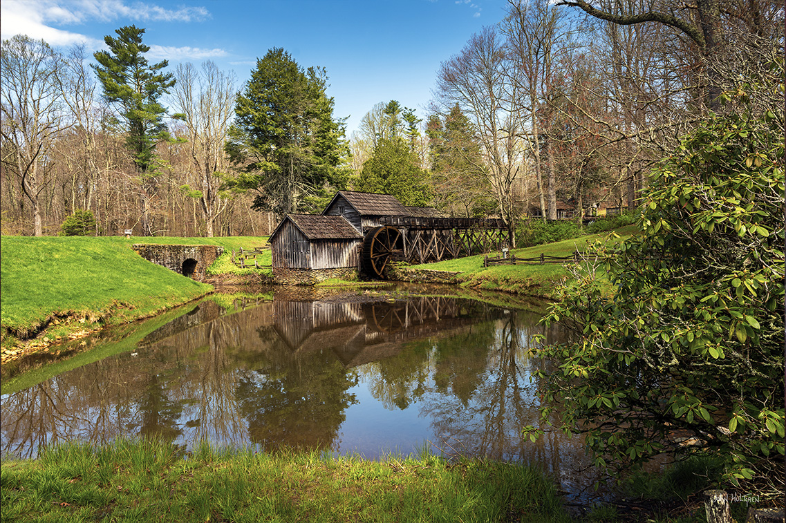
| 176.1 |
Mabry Mill
GPS: N 36°44.9898', W 080°24.3084' An early 1900s wooden gristmill that sits beside a stream. The Mabry Mill Restaurant is next door. The 0.5 mile Mountain Industry Trail takes you to the best views. |
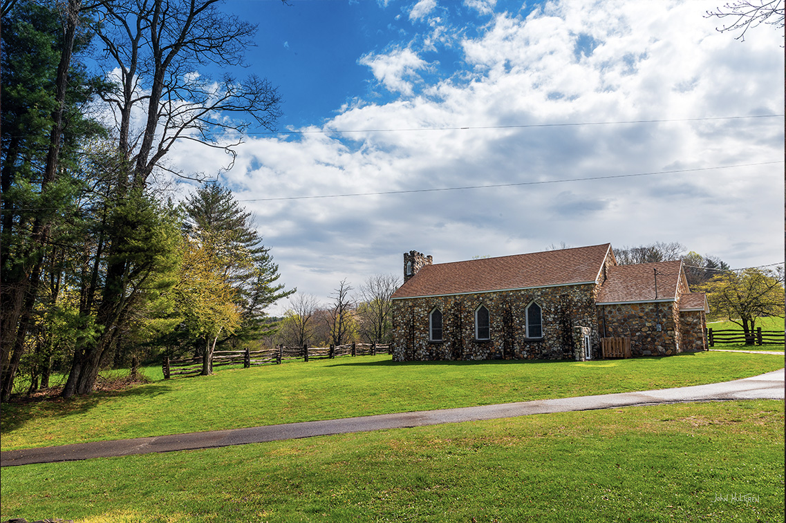
| 191.9 |
Bluemont Presbyterian Church and Cemetery
GPS: N 36°39.4950', W 080°34.4022' |
| 217.5 | Cumberland Knob Parking at GPS: N 36.5537, W 80.9081 Cumberland Knob at GPS: N 36°33.0306', W 080°54.5268' Cumberland Knob Recreation Area with 1 mile trail to the top of Cumberland Knob. |
| 241.1 |
Doughton Park
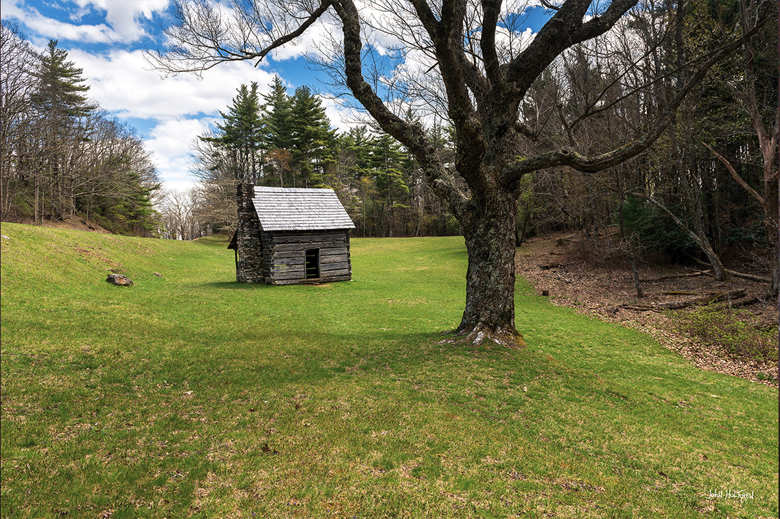
Brinejar Cabin Parking at GPS: N 36°25.1220', W 081°08.7918' Caudill Cabin at GPS: N 36°25.5930', W 081°10.2360' This is an out-of-the-way park. First is the Brinejar Cabin. For nearly 60 years, Martin and Caroline Brinejar lived on this 125-acre farm leading lives based on hard work, self-suficiency, and an abiding religious faith. Turn right at the country store after entering the recreation area, and the road will dead end at a parking lot. About a hundred feet away, you’ll find an overlook where you can peer down into a deep valley of brilliant colors in the fall. Nestled among the reds and yellows, try to spot the rustic Caudill log cabin that used to be a family’s home into the 1920s. |
| 271.9 |
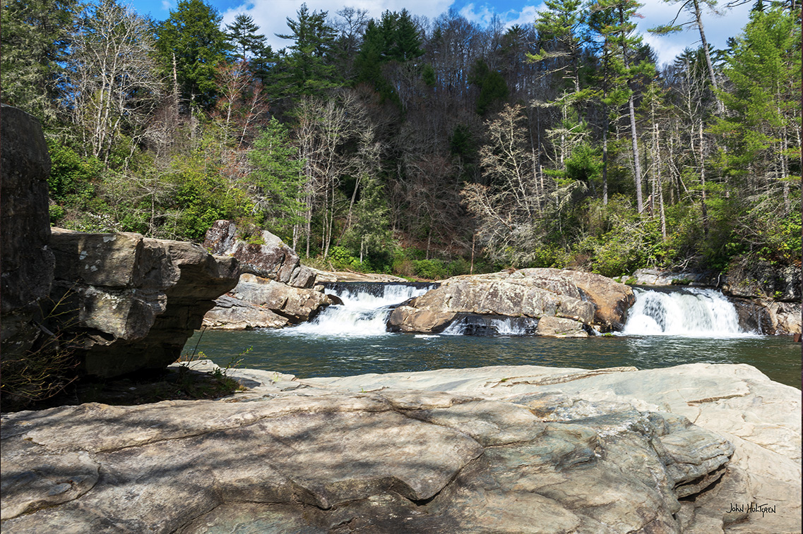
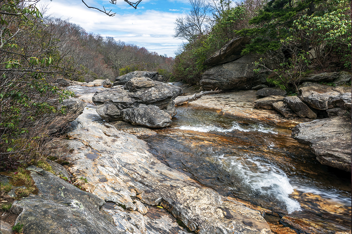
Cascade Falls
Cascades Picnic Area at GPS: N 36°14.7144', W 081°27.4800' A fairly easy 30-minute one-mile round-trip walk through a mixed hardwood forest to the thunderous Cascades of Falls Creek tucked inside E.B. Jeffress Park. The trail returns in an evergreen maze of rhododendron and mountain laurel and all the main tree species can be found along the path. An upper and a lower overlook offer different perspectives of the cascade and informational plaques identify the variety of flora beside the trail. |
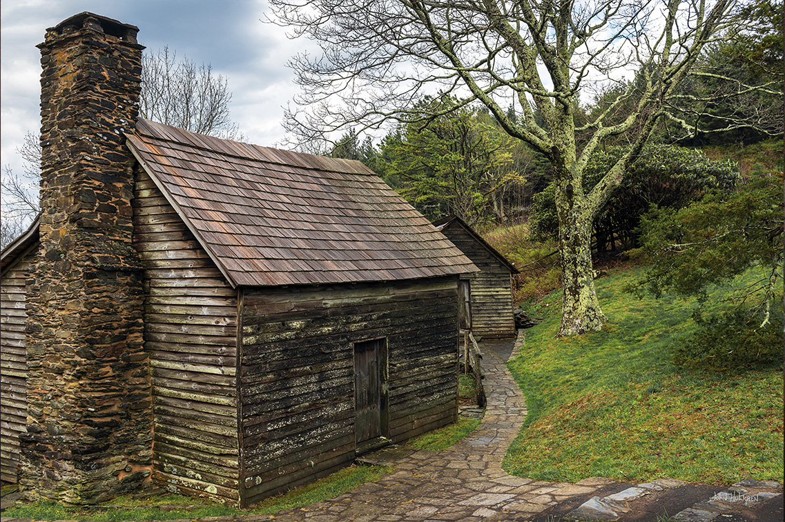
| 272.5 |
Thomkins Knob Overlook
Overlook at GPS: N 36°14.7085', W 081°27.9560' The Jesse Brown Cabin is a 19th century log cabin near a rough log church in a meadow studded with flowers in spring and summer. |
| 294.1 |
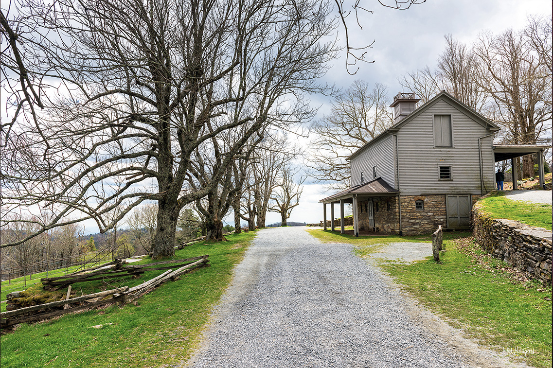
Moses H. Cone Memorial Park
GPS: N 36°08.8800', W 081°42.0660' Mansion and crafts center. Carriage paths that are open to horses. Moses Herman Cone (1857 – 1908) was an American textile entrepreneur, conservationist, and philanthropist who began his career in sales and became an innovator who offered finished clothing, which was unusual in an era when textiles were normally sold as unfinished cloth. Cone manufactured unusual textile fabrics and founded a company that became a leading manufacturer of denim, becomming a major supplier to Levi Strauss and Company for nearly a century. After his death his wife donated the Flat Top Mansion property to the Moses H. Cone Memorial Hospital which later conveyed the property to the National Park System. |
| 304.4 |
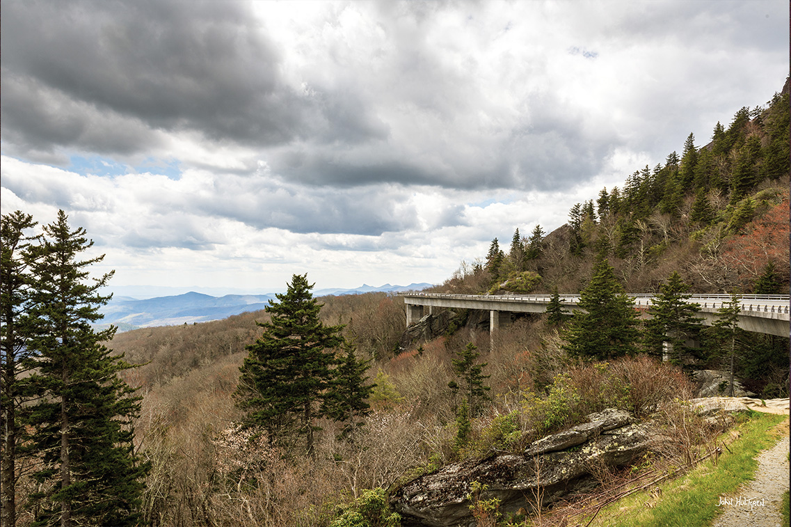
Linn Cove Viaduct
GPS: N 36°05.6064', W 081°48.7794' Visitors Center at GPS: N 36°05.4179', W 081°48.8659' Visitor Center with a viewpoint from below. The Linn Cove Viaduct is a 1,243 foot concrete segmental bridge which snakes around Grandfather Mountain, built in an effort to avoid the effects that a traditional cut-and-fill road would have on the mountain. Completed in 1983 at a cost of $10 million, it was one of the last major construction projects on the Blue Ridge Parkway. |
| 305.2 |
Beacon Heights Overlook
Beacon Heights Parking at GPS: N 36°05.0400', W 081°49.8072' Beacon Heights at GPS: N 36°04.9404', W 081°49.8066' Beacon Heights is a short one-mile round-trip hike offering spectacular views from several rock platforms. |
| 308.3 |
Flat Rock Parking Area
Flat Rock Trail Parking at GPS: N 36°03.0510', W 081°51.4476' Flat Rock at GPS: N 36°03.0540', W 081°51.6576' A fairly easy 30-minute round-trip hike to Flat Rock with an impressive view of the Linville Valley and Grandfather Mountain. Interesting trees, flowers, animals, and geological features along the way. Peer over the edge of the rocky outcropping for an expansive view of the valley, or look up to see the mountain peak rise above the neighboring ridges. Despite its name, the top isn’t exactly flat. Wind and rain have carved shallow basins into the rock like craters on the moon. |
| 316.4 |
Linville Falls Recreation Area
Linville Falls Visitors Center and the Erwins View Trail at GPS: N 35°57.2748', W 081°55.6644’ Upper Falls Overlook at GPS: N 35°56.9922', W 081°55.6206' A spur road leads 1.5 miles to the waterfall. Trails to the waterfall spread out in fingers from a visitor center at the end of the spur road to various viewpoints. The Erwins View Trail is a moderate 1.6 mile round trip with four overlooks. |

| Milepost | Attraction |
|---|---|
| 320.8 |
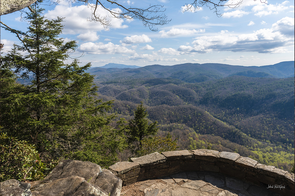
Chestoa View Overlook
Parking at GPS: N 35°55.6086', W 081°57.2412' One of the easiest overlooks to miss along the Blue Ridge Parkway also happens to be the one with a very stunning view. A small sign marks the entrance of Chestoa View Overlook. A short stroll to a stone observation deck atop a cliff unveils a spectacular panorama of the Linville Gorge. You can even see Grandfather and Table Rock Mountains in the distance. |
| 355.3 |
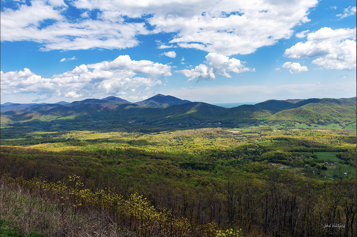
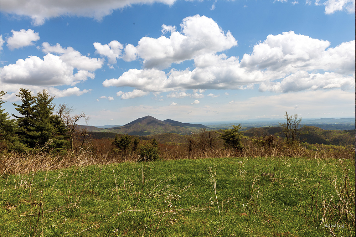
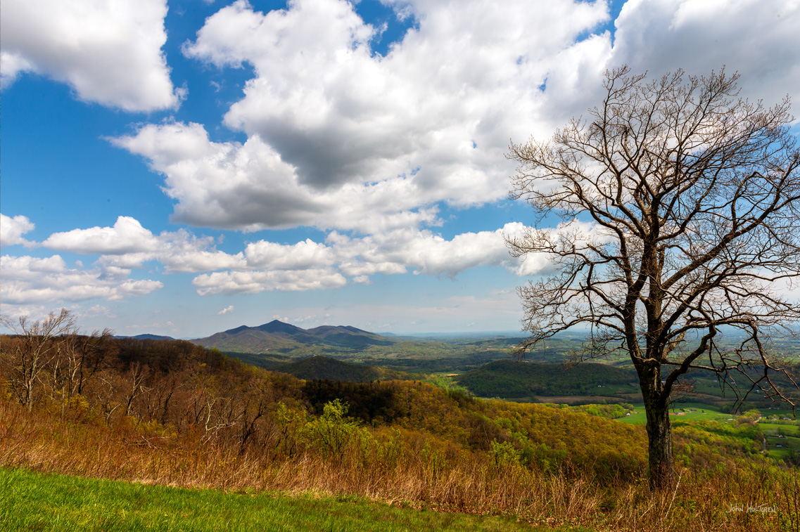
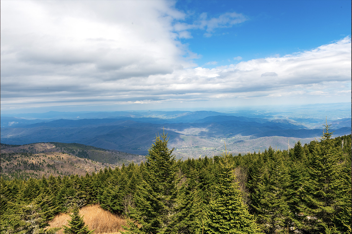
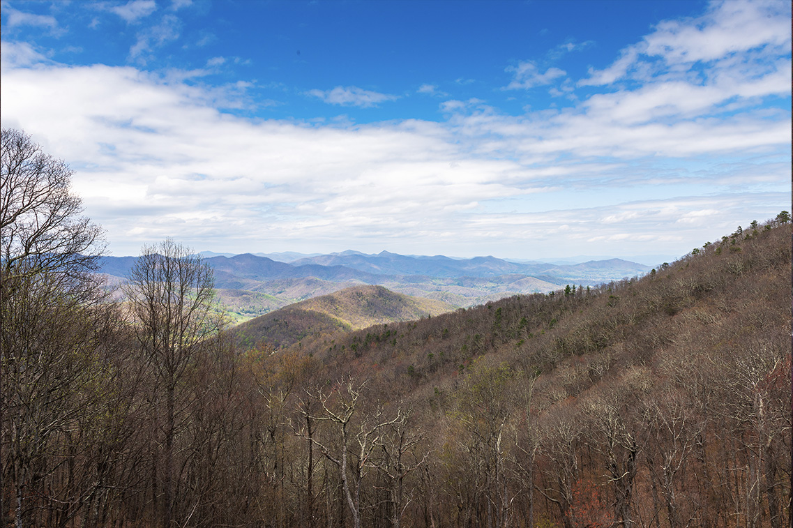
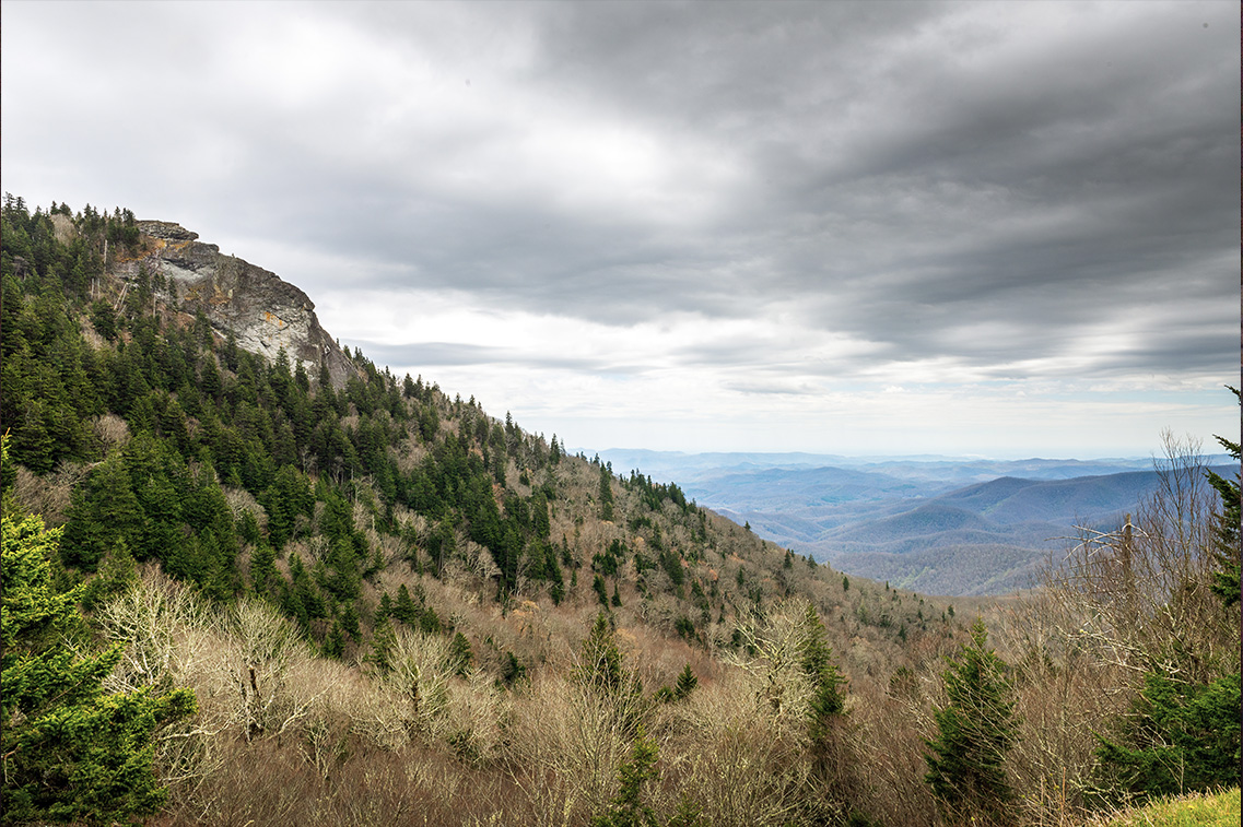
Mount Mitchell
Parking at GPS: N 35°46.0110' N, W 082°15.8982' At 6,684 feet, Mount Mitchell rises higher than any other in the Appalachians and it is the highest mountain east of the Mississippi. On a cloudless day, hikers can see up to eighty-five miles into the distance. Despite its soaring height, Mitchell doesn’t demand a lot of hiking and visitors can drive almost all the way to the top. Directly adjacent to the Blue Ridge Parkway in Mount Mitchell State Park, with no entrance fee. |
| 364.1 |
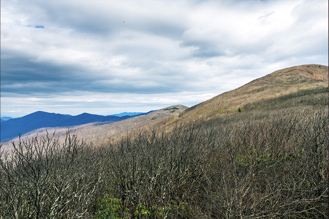
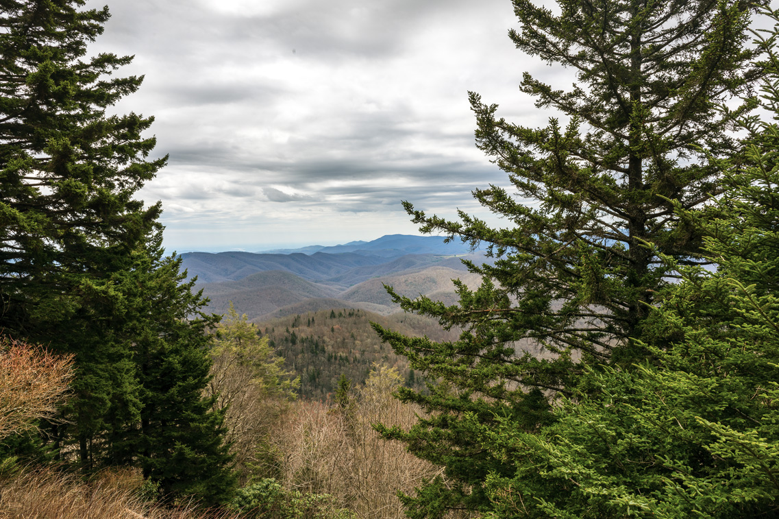
View Craggy Dome
Craggy Dome Overlook Parking at GPS: N 35°42.2574', W 082°22.4196' A 1.4-mile round-trip hike to the top of the 5,892-foot summit. Exceptional panoramic 360-degree views. The hiking trail goes through tunnels of rhododendron, gnarled sweet birch trees and wildflowers, and much of this hike feels like you’ve stumbled into a fairy’s mythical forest. |
| 404.2 |
Hominy Valley Overlook
Overlook at GPS: N 35°26.8506', W 082°43.0380' Good view of Pisgah Ridge. |
| 417 |
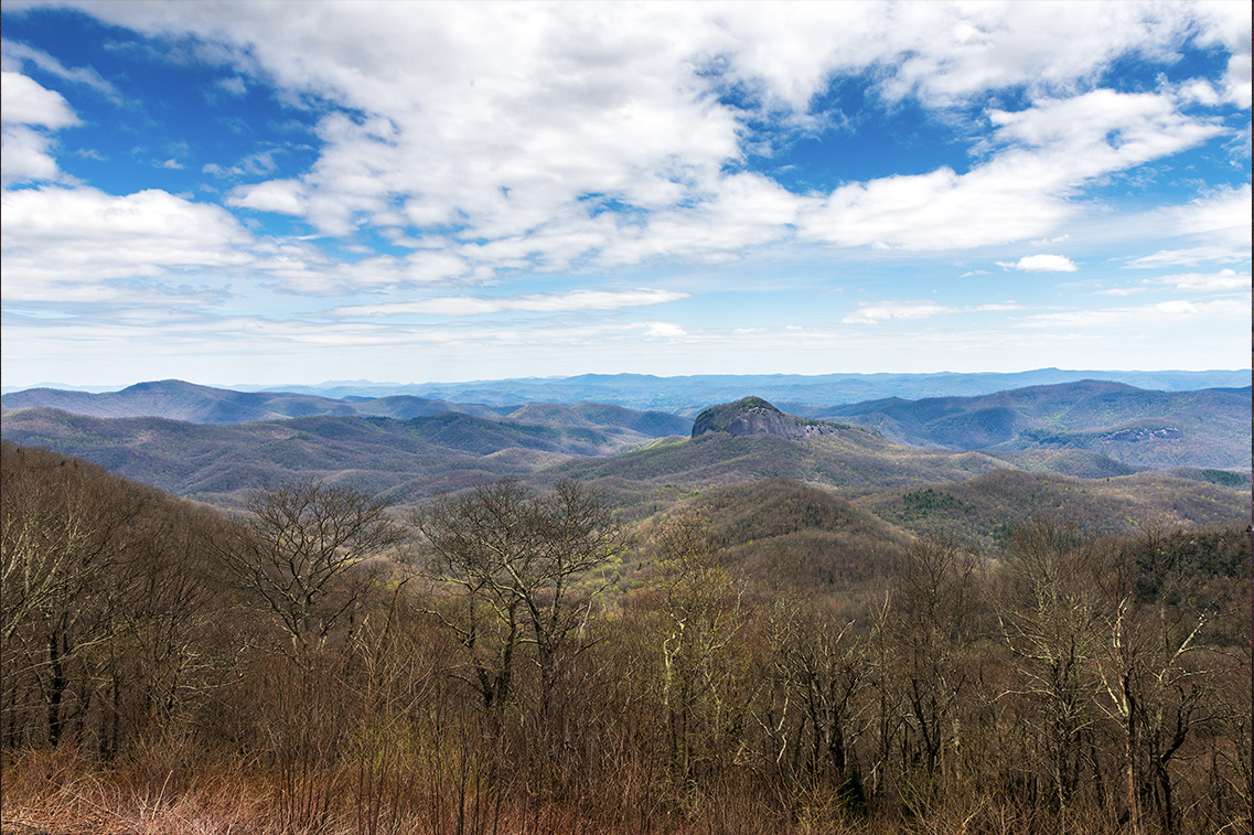
Looking Glass Rock Overlook
Overlook at GPS: N 35°19.3764', W 082°49.6849' Giant granite dome, nearly treeless, rising 1,000 feet above the forest. |
| 418.8 |
Graveyard Fields Overlook
Overlook at GPS: N 35°19.2120', W 082°50.8362' Lower Falls at GPS: N 35°19.3320', W 082°50.8200' Wind-thrown tree trunks covered with moss and spruce needles looked like a graveyard until it was destroyed by fire in 1925. A very popular hiking trail with two waterfalls. |
| 422.4 |
The Devil’s Courthouse
Parking at GPS: N 35°18.3132', W 082°53.9664' Devil’s Courthouse at GPS: N 35°18.1686', W 082°53.7300' An overlook with a good view. |
| 424.8 |
Wolf Mountain Overlook
Overlook at GPS: N 35°18.1128', W 082°56.0658' The valley below Wolf Mountain contains Wolf Lake. This area was home to large numbers of Timberwolves before 1900. By then, bounty hunters, farmers and cattlemen hunted the wolves to extinction. |
| 431.4 |
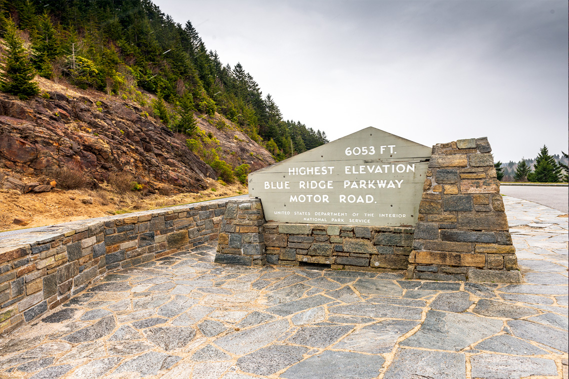
Richland Balsam Overlook
Overlook at GPS: N 35°21.7586', W 082°59.5195' Highest elevation along the Blue Ridge Parkway Motor Road at 6,053 feet. |
| 433.3 |
Roy Taylor Forest Overlook
Overlook at GPS: N 35°22.7346', W 083°00.9084' |
| 450.2 |
Yellow Face Overlook
Overlook at GPS: N 35°27.5259', W 083°07.8668' |
| 451.2 |
Waterrock Knob
Waterrock Knob Road Parking at GPS: N 35°27.6180', W 083°08.4390' Pedestrian Overlook at GPS: N 35°27.7326', W 083°08.3964' Crash Site at GPS: N 35°27.7800', W 083°07.9050' Just eighteen miles from the end of the parkway with a picturesque panorama of the mountains from the parking lot. The summit hike is short but steep, climbing 412 feet in elevation. The peak is rich in Appalachian mountain views at sunrise and sunset. If you’re willing to venture down a more rugged path, take a left at the fork just before the summit to find an abandoned plane crash from 1983 when a Cessna 414 was flying from West Chicago to the Jackson County Airport. Neither the pilot nor the one passenger survived, so please be respectful. |
| 458.2 |
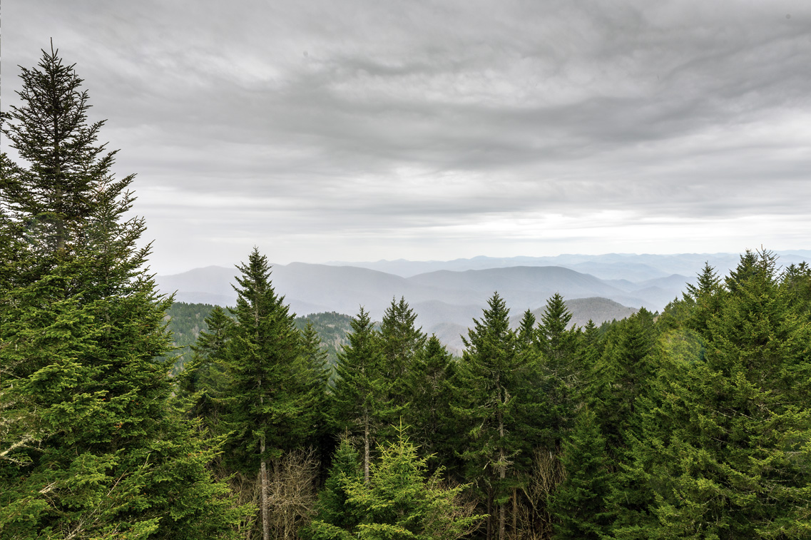
Heintooga Spur Road
Mile High Overlook at GPS: N35°31.1622’, W083°10.7112’ Mile High Overlook offers a good high-elevation overlook looking down on the mountain ridges and is one of the most photogenic sunset locations in the park. Access Heintooga Ridge Road off of the Blue Ridge Parkway and drive to Mile High Overlook. |
| 469.1 | Great Smoky Mountains National Park GPS: N 35°30.3300', W 083°18.0540' |

 ADVERTISEMENT